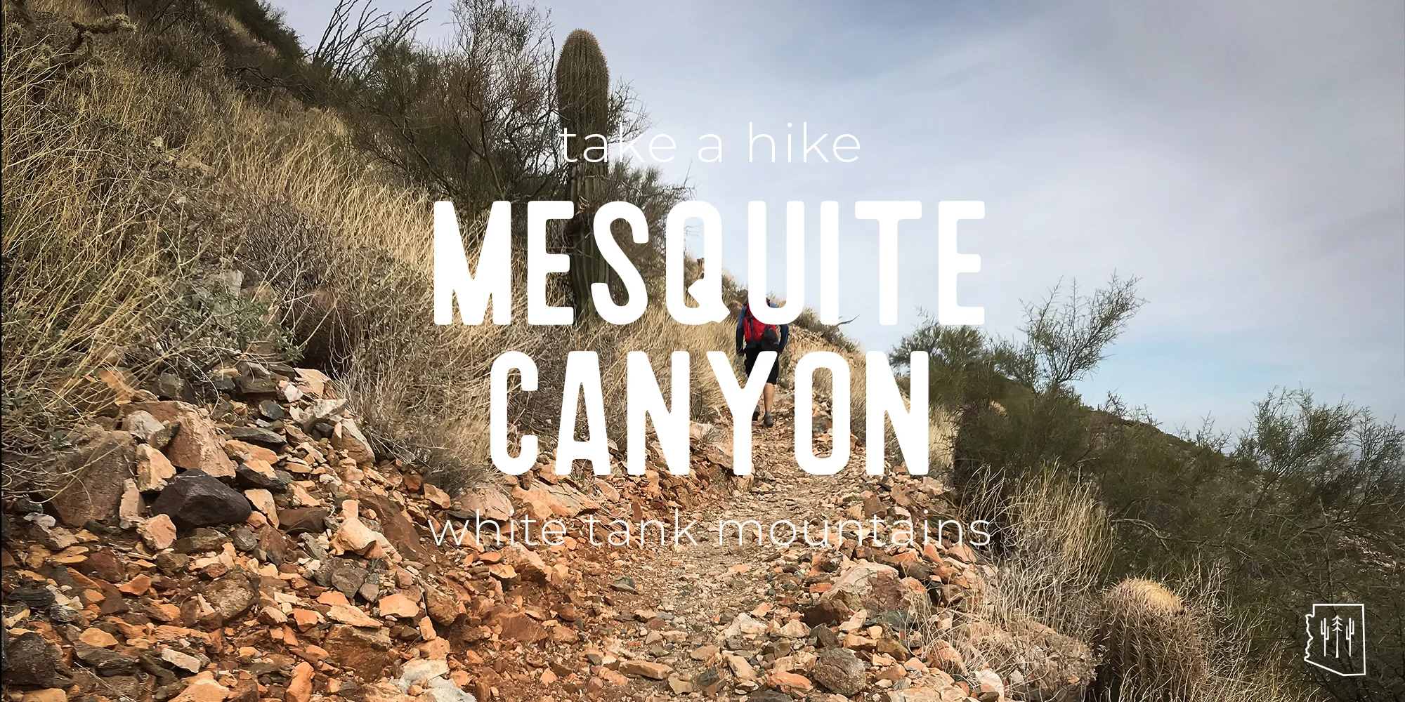
Hike | Mesquite Canyon Trail | White Tank Mountains
TRAIL DESCRIPTION
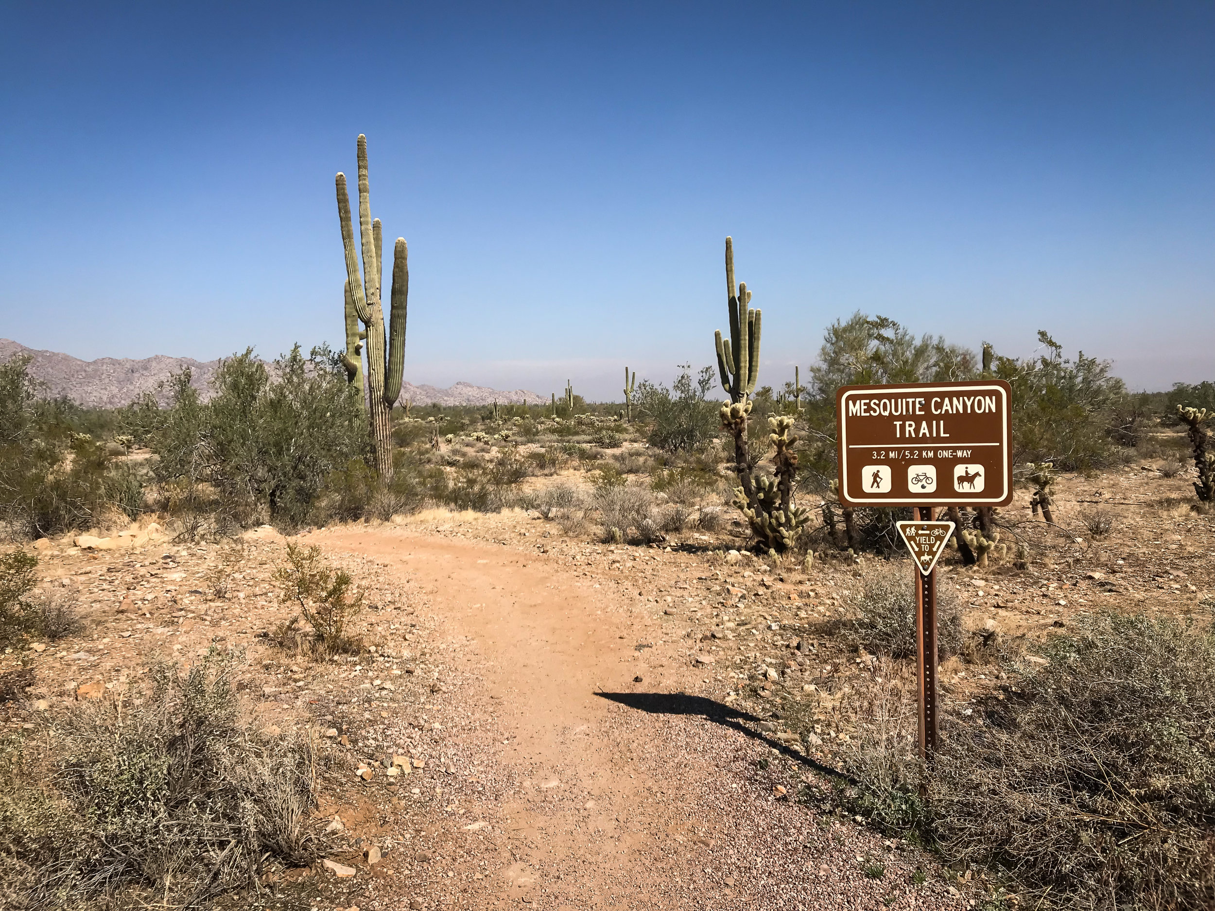
Mesquite Canyon Trail might push newer hikers out of their comfort zones, but the stunning views and peaceful journey through the backcountry of the mountains is worth the effort. This multi-use trail begins at the horse staging area off White Tank Mountain Road.
TRAIL STATS
- Distance: 5.0 miles one way
- Type of Trail: Out and back
- Elevation Gain/Loss: 1483 ft. between low and high points
- Difficulty: Difficult
- Amenities: Drinking fountains and bathrooms
- Dog-Friendly: Yes
- Hours of Operation: Su – Thu: 6:00 a.m. to 8:00 p.m., Fri – Sat: 6:00 a.m. to 10:00 p.m.
- Entrance Fees: $6.00 per vehicle (as of 3/1/2018) or $2.00 per pedestrian (as of /1/2018)
THE HIKE


We took the option of parking at Picnic Area 7, just off Waterfall Canyon Road. This saves almost a mile of walking through flat, desert terrain and puts you right at the base of the mountain.
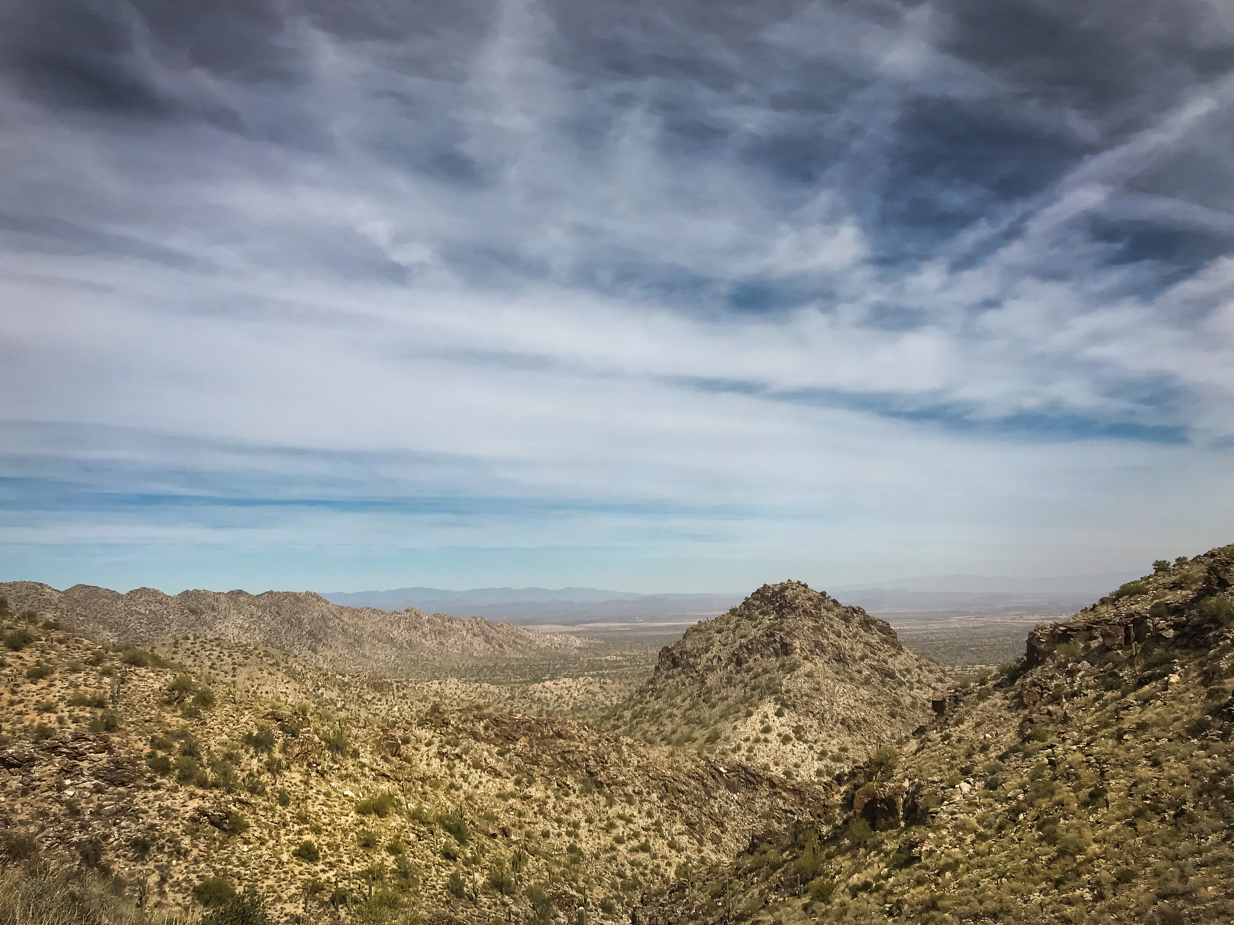
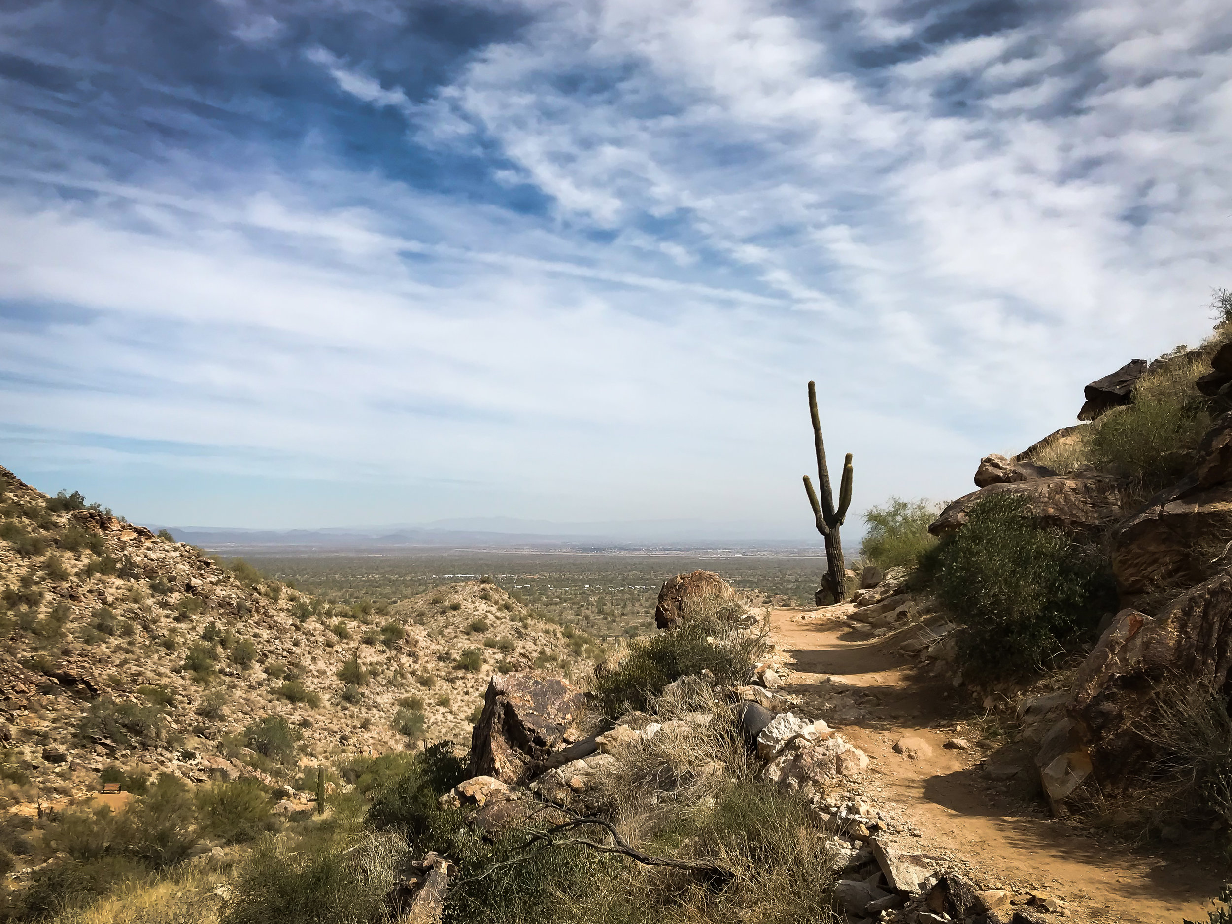
It wasn’t long before we began the ascent via switchbacks. Though the incline is steady, the trail here is well groomed and easy to navigate. This portion of the hike is moderately trafficked, but the trails are wide enough and accommodating. We reached the summit just before mile marker 2, which is a great spot for photographs. On a clear day, you can see across the entire valley as far as Camelback Mountain, the McDowells, and possibly even the Superstitions. We noticed that many hikers turn back at this point—we encountered very few during the rest of the hike. We continued down the trail admiring the rock formations as well as the outcroppings of cholla, prickly pear, and saguaros.
Once you reach the juncture between Mesquite Canyon and Willow Canyon Trail, you have a couple of options. The trail is considered an out and back, and you can certainly take Mesquite Canyon all the way out to mile marker 5 and then head back exactly the way you traveled. If you’re like us, we’ll always take a loop option over an out and back so we can see something new. We decided to take Mesquite Canyon Trail all the way to mile marker 5 where we then hopped onto a small length of Ford Canyon Trail. From there, we finished the loop with the entirety of Willow Canyon Trail, right back to the original juncture. This clockwise lollipop can also be done counterclockwise with the Willow Canyon portion first.
You can expect moderate variations in elevation as well as narrowing trails and occasional loose rock. I took note of the changing geology as the rock changed color from dark brown, to red, to white. Small lizards scampered out in front of us from time to time, and I spotted a mule deer hoof print on the trail. Once in awhile, mountain bikers would come up behind us, and we would let them whiz by. When we returned to the Mesquite Canyon and Willow Canyon Trail juncture, we journeyed back the same two miles that began the hike, but this time taking the switchbacks downhill. If you decide to hike the trail as a lollipop, or partial loop, using Picnic Area 7 as the start, the entire hike is approximately 8 miles.
The best part of hiking in White Tank Mountains is its versatility in customizing routes. My favorite part of the hike was the 1.6-mile stretch of Willow Canyon. There is a moment where you find yourself in a low patch of long, green grass under a shaggy tree that I think might be an ironwood, and then soon after, you’re back up on the mountain with the trail carved in its side and visible from half a mile away. That view of the valley from up there, whether the sky is cloudless or full of clouds, is breathtaking.
GETTING THERE
From the north: Take Highway 303 south and exit at Peoria Avenue. Turn right and travel west for 1 mile on Peoria Avenue. Turn left (south) onto Cotton Lane. Turn right (west) on Olive Avenue. Continue 4 miles to the park gate.
From the south: Take Highway 303 north and exit at Northern Avenue. Turn left (west) onto Northern Avenue and travel west for 1 mile. Turn right (north) onto Cotton Lane. Turn left (west) onto Olive Avenue. Continue 4 miles to the park gate.
HIKING TIPS
Park hours allow for stunning views at sunrise and sunset.
Pack plenty of water and a hat or sunscreen as there is little shade cover on the trail.
In the warmer months, get an early start since much of the trail is in full sun.
Wear shoes or boots with good tread as a portion of the trail is covered in loose rock.
Plenty of trashcans are located at the trailheads. Make sure to leave the park better than you found it.
The building located near the park entrance houses the Nature Center, the Regional Library, and a bookstore. You’ll find vending machines, bathrooms, and drinking fountains. Stop in for a quick visit to the Nature Center to pick up maps, snacks, souvenirs, and trail information.
Hours for the Nature Center are:
- Summer (5/09 - 10/09) Monday thru Saturday: 8 a.m. - 3 p.m. Sunday: Closed
- Winter (10/10 - 5/08) Sunday thru Saturday: 8 a.m. - 4 p.m.
THE NARRATOR
This blog was thoughtfully written by Jia Oak Baker. You can find her on Instagram at @violetsky29.
* Please remember to hike at your own risk. To learn more please refer to our Hiking Disclaimer.